

The Big Dawg Weather Blog is presented by:
.PNG)
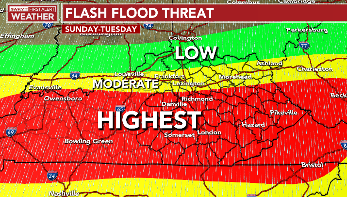
Good Friday Afternoon, Folks! Parts of Eastern Kentucky have witnessed historic flooding over the past few days, and they are still on guard for additional flooding today through Tuesday. Most of the state will see the flood threat increase again, beginning Saturday night Through Tuesday. Showers and thunderstorms are expected to increase in intensity on Sunday. Multiple rounds of persistent heavy rainfall could cause isolated flooding concerns. WKYT in Lexington has highlighted much of Central and Southern Kentucky for the highest Flooding threat Sunday through Tuesday! We will keep you updated over the weekend, but it's important to stay weather aware, especially if you live in flood-prone or poor drainage areas!
Flash Flood Threat from WKYT

.png)