
The Big Dawg Weather Blog is presented by:
.PNG)
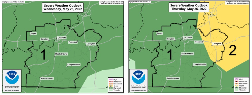
Good Evening, folks! Tonight, scattered thunderstorms could become strong, with locally damaging wind gusts as the main hazard. Lightning and hail are also possible; however, im expecting this to be a shallow threat. Thunderstorms will be possible on Thursday, and heavy rain could result in localized flooding in locations with repeated rainfall. Locally damaging winds and hail will also be possible in stronger storms. Showers and thunderstorms will continue into Friday; again, some strong storms with localized heavy rainfall are possible. The SPC has placed our area in a Marginal Risk for severe weather tonight and tomorrow, the lowest severe weather risk. This means that Isolated severe storms are possible but are limited in duration and intensity.
The holiday weekend looks very lovely, with sunny conditions expected on Saturday (High 74), Sunday(High 82), and Monday(High 87).
Have a great night, everyone!

.png)