

The Big Dawg Weather Blog is presented by:
- A-Plus Comfort Care
- Central Ky Construction & Concrete
- Razed Right Barbershop
- Insulation Solutions of Ky
.PNG)
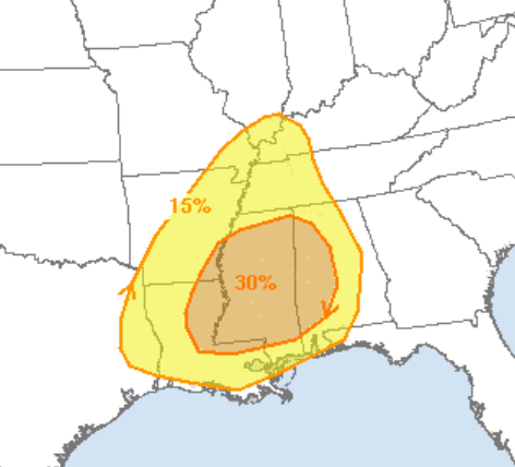
Good Sunday Evening, Folks! I am monitoring the potential for very gusty winds and strong or severe thunderstorms on Wednesday into early Thursday morning ahead of a strong cold front. Wind fields are more than sufficient for organized severe weather, and the pattern also favors it. However, there is some uncertainty in how much energy these storms have to work with. For now, the SPC Outlook remains to the south and west of our region, where the most significant threat is expected to be, but I still expect central Kentucky to be placed in some type of severe risk in later outlooks. Damaging winds with brief spin-up tornadoes are the main threats right now. I will monitor this system this week and give updates as needed! Stay tuned!
SPC OUTLOOK

.png)