

The Big Dawg Weather Blog is presented by:
- A-Plus Comfort Care
- Central Ky Construction & Concrete
- Razed Right Barbershop
- Insulation Solutions of Ky

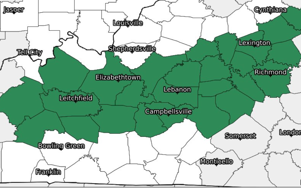
Good Sunday morning, folks. A frontal boundary will stall across central Kentucky today. Showers and storms will develop and train along this boundary, resulting in heavy rain and potential flash flooding periods. A strong gusty shower or storm could also develop this afternoon. The National Weather Service Service has issued a Flood Watch for the areas they believe has the most significant potential for flash flooding.
We are also looking at a severe weather threat this afternoon and early tomorrow morning. Damaging winds are the main threat, but an isolated tornado can't be ruled out. The SPC has placed much of the state in a SLIGHT risk for severe weather, which means scattered severe storms are possible.
.PNG)
Stay weather aware today, we'll keep you updated on the latest!

.png)